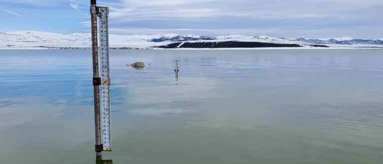
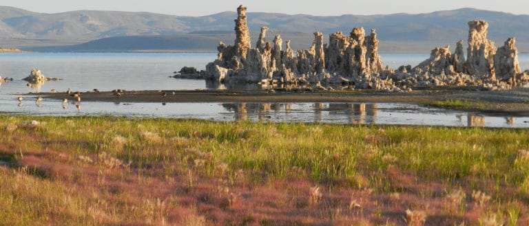
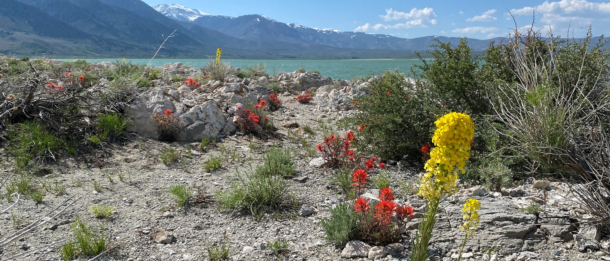
Thursday, February 13th, 2020 by Greg, Information & Restoration SpecialistcloseAuthor: Greg, Information & Restoration SpecialistName: Greg Reis Title: Information & Restoration Specialist About: Since his internship with the Mono Lake Committee in 1995, Greg has been deeply involved with Mono Basin restoration and research. He studied Forestry & Natural Resources at Cal Poly San Luis Obispo, and has followed
the thalweg of hydrology, resource management, watershed management, and habitat restoration ever since. Greg lives in the Bay Area with his wife and two kids, where he also works for The Bay Institute's Rivers and Delta Program.See All Posts by Greg (187) Contact Greg
Rush Creek flows above Grant Lake Reservior have been in the single-digits since mid-December. When adjusted for changes in Southern California Edison reservoir storage upstream, unimpaired near-natural runoff can be calculated. These unimpaired flows averaged 5.7 cubic feet per second (cfs) in January 2020—the lowest that I can remember seeing for a monthly average.
A portion of the USGS Mono Craters Quadrangle geologic map, with the Parker Creek stream gauge circled in red at top and the Rush Creek gauge circled in red in the middle. The Parker Creek watershed for its size has proportionally more surface sediment deposits above the gauge, and the gauge is lower in elevation than the Rush Creek gauge. Both gauges reported similar unimpaired flows in January after five months of very low precipitation.
For comparison, flows in Parker Creek—a much smaller creek than Rush Creek—averaged 5 cfs in January. Interestingly, Parker Creek has two glaciers in its watershed and Rush Creek has none, a difference that would tend to affect summer flows more than January flows. (more…)
Saturday, December 7th, 2019 by Arya, Communications DirectorcloseAuthor: Arya, Communications DirectorName: Arya Harp Title: Communications Director About: Arya oversees the Committee's communications program, which includes the Mono Lake Newsletter and the Mono Lake Calendar. She loves her job because she gets to share the inspiring work of the Mono Lake Committee with members and visitors alike. Her favorite things to do in the Mono Basin include ice skating on nearby lakes, skiing the Mono Craters, and getting to smell the sagebrush when it rains.See All Posts by Arya (211) Contact Arya
The Mono Lake Committee’s 2019 Annual Report is now available online and in print!
The 2019 Mono Lake Committee Annual Report is now available online. Photo courtesy of Thomas Piekunka.
The report is full of photos of the Mono Lake Committee in action in our focus areas of protection, restoration, education, and scientific research. It also has the Committee’s (more…)
Wednesday, March 20th, 2019 by Arya, Communications DirectorcloseAuthor: Arya, Communications DirectorName: Arya Harp Title: Communications Director About: Arya oversees the Committee's communications program, which includes the Mono Lake Newsletter and the Mono Lake Calendar. She loves her job because she gets to share the inspiring work of the Mono Lake Committee with members and visitors alike. Her favorite things to do in the Mono Basin include ice skating on nearby lakes, skiing the Mono Craters, and getting to smell the sagebrush when it rains.See All Posts by Arya (211) Contact Arya
It’s that time of year again, when all eyes are on the Sierra snowpack, the level of Mono Lake, and spreadsheets.
How much will Mono Lake rise or fall this year? Photo by Andrew Youssef.
Just imagining this winter’s snowpack flowing down Mono Basin streams this spring brings a gleeful sigh of relief. But … spreadsheets? Yep, because spreadsheets, forecast models, experts, and in-depth Mono Basin hydrologic knowledge, when carefully woven together, are how we figure out the big question for Mono Lake: how much is the lake going to rise or fall this year?
Friday, March 8th, 2019 by Maureen, Membership AssistantcloseAuthor: Maureen, Membership AssistantName: Maureen McGlinchy Title: Membership Assistant About: Originally from New Jersey, Maureen first moved to the Sierra Nevada in 2002 as a seasonal biologist in Yosemite. Ten years later, she and her family were fortunate enough to land in Lee Vining. She has a background in forest ecology and she's always excited to broaden her understanding of the natural and man-made processes at work in the Mono Basin. You can find Maureen out trail-running with Garnet the dog, trying to keep up with
her speedy daughters on June Mountain, or relaxing with friends somewhere next to water.See All Posts by Maureen (2) Contact Maureen
In a winter full of snow, getting down to the lake has been a bit more challenging and a lot more fun.
A calm lake surface in not only incredibly scenic but ideal for lake level readings. With the onslaught of storms we’ve experienced this winter, a glassy lake has been a rare sight. Photo by Robbie Di Paolo.
The Mono Lake Committee monitors Mono Lake’s level throughout the year, at least once a month and usually more frequently. You can find monthly lake levels going back to 1971 here. The most important lake level reading of the year happens on (more…)
Tuesday, March 5th, 2019 by Greg, Information & Restoration SpecialistcloseAuthor: Greg, Information & Restoration SpecialistName: Greg Reis Title: Information & Restoration Specialist About: Since his internship with the Mono Lake Committee in 1995, Greg has been deeply involved with Mono Basin restoration and research. He studied Forestry & Natural Resources at Cal Poly San Luis Obispo, and has followed
the thalweg of hydrology, resource management, watershed management, and habitat restoration ever since. Greg lives in the Bay Area with his wife and two kids, where he also works for The Bay Institute's Rivers and Delta Program.See All Posts by Greg (187) Contact Greg
Wow! With 53.3″ of snowfall, February 2019 was Lee Vining’s snowiest February on record. The Lee Vining record begins in 1989, with the previous record 49.0″ of total snowfall in February 1998.
February 2019 was Lee Vining’s snowiest February on record, and included days when it was possible to ski along the shore of Mono Lake. Photo by Robbie Di Paolo.
Total snowfall for January and February 2019 was the third-largest on record with 78.5″, lagging behind the same time-frame in 2008 with 91.4″ of snow and 1993 with 81.2″ of snow. Snowfall this past February was 313% of average, and the January–February total was 209% of average. The (more…)
Thursday, June 7th, 2018 by Greg, Information & Restoration SpecialistcloseAuthor: Greg, Information & Restoration SpecialistName: Greg Reis Title: Information & Restoration Specialist About: Since his internship with the Mono Lake Committee in 1995, Greg has been deeply involved with Mono Basin restoration and research. He studied Forestry & Natural Resources at Cal Poly San Luis Obispo, and has followed
the thalweg of hydrology, resource management, watershed management, and habitat restoration ever since. Greg lives in the Bay Area with his wife and two kids, where he also works for The Bay Institute's Rivers and Delta Program.See All Posts by Greg (187) Contact Greg
Peak snowmelt runoff on Mono Lake’s tributary streams is occurring!
Restoration Field Technician Robbie Di Paolo retrieves a temperature logging device in high flows on Rush Creek. Photo by Andrew Youssef.
Lundy Lake Reservoir is spilling, and the Rush Creek peak flow of 380 cubic feet per second (cfs) below Grant Lake Reservoir is being released over the next five days. So far, snowmelt runoff above the aqueduct has peaked at 272 cfs on Rush Creek, 238 cfs on Lee Vining Creek, 46 cfs on Parker Creek, and 23 cfs on Walker Creek. The flows should begin to subside soon given the rapid melting and limited snowpack. (more…)
Tuesday, April 3rd, 2018 by Greg, Information & Restoration SpecialistcloseAuthor: Greg, Information & Restoration SpecialistName: Greg Reis Title: Information & Restoration Specialist About: Since his internship with the Mono Lake Committee in 1995, Greg has been deeply involved with Mono Basin restoration and research. He studied Forestry & Natural Resources at Cal Poly San Luis Obispo, and has followed
the thalweg of hydrology, resource management, watershed management, and habitat restoration ever since. Greg lives in the Bay Area with his wife and two kids, where he also works for The Bay Institute's Rivers and Delta Program.See All Posts by Greg (187) Contact Greg
Snow surveys conducted around every April 1st coincide with the average date of peak snowpack. This year, the surveys were completed at the end of March and revealed a large increase in snowpack over the previous month—from 50% of average to 76% of average!
Map of snow survey locations compiled by Robbie DiPaolo. The Lee Vining Creek watershed above the DWP diversion dam and the Rush Creek watershed above the SCE powerhouse are outlined in red.
Tuesday, March 21st, 2017 by Greg, Information & Restoration SpecialistcloseAuthor: Greg, Information & Restoration SpecialistName: Greg Reis Title: Information & Restoration Specialist About: Since his internship with the Mono Lake Committee in 1995, Greg has been deeply involved with Mono Basin restoration and research. He studied Forestry & Natural Resources at Cal Poly San Luis Obispo, and has followed
the thalweg of hydrology, resource management, watershed management, and habitat restoration ever since. Greg lives in the Bay Area with his wife and two kids, where he also works for The Bay Institute's Rivers and Delta Program.See All Posts by Greg (187) Contact Greg
Last week the Los Angeles Department of Water & Power (DWP) released its preliminary runoff forecast based on record-breaking March 1st snow surveys: 195% of average runoff for the April 1, 2017 through March 31, 2018 runoff year. This volume of runoff is very similar to 1983, the wettest runoff year on record. Due to the warm storms in January and February, the lower-elevation snowpack below about 9,000 feet above sea level is much lower than in 1983, so we are assuming that record runoff is a high-end scenario. That forecast also assumes median precipitation over the next year.
Based on 1983 as a high end, 1995 as a probable scenario, and 2006 as a lowest possible scenario, we modeled the likely rise in Mono Lake based on those past year inflows and probable reservoir operations this year. The result? A 3.8-foot rise in Mono Lake is likely over the next year. Expected Grant Lake Reservoir operations add about half a foot to our forecast.
A 3.8 foot rise in Mono Lake is likely over the next year. (Click on the graph to enlarge it.) Graph by Greg Reis.
All three scenarios have little or no rise before May and a similar rise in May and June, since snow can only melt so fast, (more…)
Tuesday, March 7th, 2017 by Greg, Information & Restoration SpecialistcloseAuthor: Greg, Information & Restoration SpecialistName: Greg Reis Title: Information & Restoration Specialist About: Since his internship with the Mono Lake Committee in 1995, Greg has been deeply involved with Mono Basin restoration and research. He studied Forestry & Natural Resources at Cal Poly San Luis Obispo, and has followed
the thalweg of hydrology, resource management, watershed management, and habitat restoration ever since. Greg lives in the Bay Area with his wife and two kids, where he also works for The Bay Institute's Rivers and Delta Program.See All Posts by Greg (187) Contact Greg
After the wettest February since 1986 at some survey sites, Mono Basin snowpack is more than double the March 1st average!
Snow water equivalent (SWE) ranges between 205% and 244% of average at the five snow survey sites in the Mono Basin (called snow courses). Gem Pass, Ellery Lake, and Saddlebag Lake have the highest March SWE on record. At the lowest-elevation snow survey site—Gem Lake at 9,150 feet above sea level—SWE was about 10 inches shy of the 1969 record, but it had reached the 1983 amount. The Tioga Pass snow course was 5 inches shy of the 1983 record. In the map below showing the snow courses, portions of the Lee Vining Creek (top) and Rush Creek (bottom) watersheds are outlined.
At Ellery Lake and Saddlebag Lake, in the Lee Vining Creek headwaters, March 1st SWE was already higher than the record April 1st SWE set in 1983! Map by Robbie DiPaolo.
Sunday, February 5th, 2017 by Greg, Information & Restoration SpecialistcloseAuthor: Greg, Information & Restoration SpecialistName: Greg Reis Title: Information & Restoration Specialist About: Since his internship with the Mono Lake Committee in 1995, Greg has been deeply involved with Mono Basin restoration and research. He studied Forestry & Natural Resources at Cal Poly San Luis Obispo, and has followed
the thalweg of hydrology, resource management, watershed management, and habitat restoration ever since. Greg lives in the Bay Area with his wife and two kids, where he also works for The Bay Institute's Rivers and Delta Program.See All Posts by Greg (187) Contact Greg
February 1 snow surveys conducted over the past week revealed an approximately 200% of average snow water content in the Mono Basin. This puts the April 1 average at just over 120%.
The current outlook for April 1, 2017 peak snowpack at the Mono Basin’s five snow courses based on February 1 snow surveys and historic data. Graph by Greg Reis.
It is still early in the season, but even with a dry February and March, it will be an above-average year, and with an average end to the season it will be a wet year. With a wet February and March, new April 1 records could be set!